

The Koup Karoo refers to a fascinating geological depression, one of the most noticeable geographica areas in the south of South Africa, it is a vast arid area between the small and big Swartberg mountains in the south and the Nuweveldberg mountains in the north which rises to about 2000m above sea level.
It is roughly 80 km north to south and 170km from east to west and approximately covers an area of 14 000 sq.km. A stretched out undulated landscape with extremely hot summers, cold winter nights and pleasant winter days and receives less than 200mm rain a year.
The soil is shallow shale with sparse and stunted vegetation and the principal livestock are sheep, merino and dorper. The most notable town in the Koup is Merweville located nearly right in the middle at an altitude of 700m above sea level. Rietbron marks the eastern border at 770m above sea level and Laingsburg is situated at the southwestern entrance at 650m above sea level while Beaufort West lies at the northeastern corner of the Koup at 840m above sea level.

The name Koup is derived from the Khoi San word “ghoup” which means the caul fat, the stringy lacy fat around some organs and stomachs of game animals and sheep. According to folklore it refers to the surface of the area which is covered with patches of golden yellow grass and in places strung together like the caul fat. Its resemblance is quite visible in the late summer months after rain when the patches and strings of grass appears. Looking down from high above the whole region with the three river basins cutting through the area from north to south resembles the look of caul fat.
The N1 national route and railway line runs diagonally across the Koup Karoo from Beaufort West in the northeast to Laingsburg in the southwest. From Beaufort West the N1 runs along the Gamka river and passes small settlements like Kruidfontein, Welgemoed, Leeugamka and Prins Albert Road and after that it crosses the Dwyka river and finally crosses the Buffels river at Laingsburg.

Looking at the Koup from high above you will notice the origins of three main rivers that cover the area and they all run from north to south like veins. In the west you will find the Buffels river that runs through Laingsburg. The Dwyka river runs through the central part passing through Merweville and the most noticeable of them all in the eastern part is the Gamka river and they all have their origin in the Nuweveldberg mountains.
Early settlers crossed this vast area looking for water but found no surface water, their expedition took them to the foot of the Nuweveldberg mountains in the Beaufort West region where some eyes of fountains were discovered, and they settled there originally.
Only after the technology of drills and windpumps were introduced settlement started to take place in the Koup around the late 1800’s and in the beginning of 1900 Merweville was established which could be regarded as the capital of the Koup.

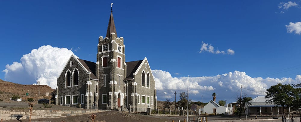
Merweville falls under the district municipality of Beaufort West and is 130 kilometres away. It was established in 1904 on the Vanderbylskraal farm and managed by a village management board until 1921. The town was named after reverend P van der Merwe (1860-1940), from Beaufort West who was instrumental for the building of the now impressive Dutch Reformed church because of the distance the congregants had to travel in those days for the communion every month.
Take a drive out to Merweville, stay a few days, and fall in love. After you have drank the water from the village, eaten the well-known Karoo lamb from a barbeque with roosterkoek you will be back for more.