

The History of Gouritsmond
The Gouritsriver enters the Indian Ocean at Gouritsmond on the southern coast of Africa at 34° 21′ 11.448” S and 21° 52′ 50.196” E, 34 km south-west of Mossel Bay.
The origin of the name could most probably be from an indigenous group of Khoikhoi people who lived in the area. According to the well-known historian, G. M. Theal, who mentioned the explorer Hieronimus Cruse, crossing the river for the first time in 1667 coming from Mossel Bay in the east while heading west. Cruse found a Khoikhoi tribe named the Gouriqua, after who the river was apparently named.

Even before the Dutch explored the coast the Portuguese already, for more than 100 years before them, drew up maps of the coastline. A river indicated in the Martellus map of 1489, is roughly where the Gourits river is. The name Rio della Vache is the name on the map which in Portuguese is Rio das Vaccas which means the river of the cows. Generally, it is accepted that after the voyage of Bartolomeu Dias it was named Rio dos Vaqueiros which means the river of the cow-herders.

Fisherman initially settled at the western part of the Gourits river mouth, later a camping site was identified, cottages were built and slowly the village of Gouritsmond started to develop. As a fishing and holiday destination, the village caters for visitors and locals alike offering accommodation, activities, a few general dealers, restaurant, liquor store and coffee shop.
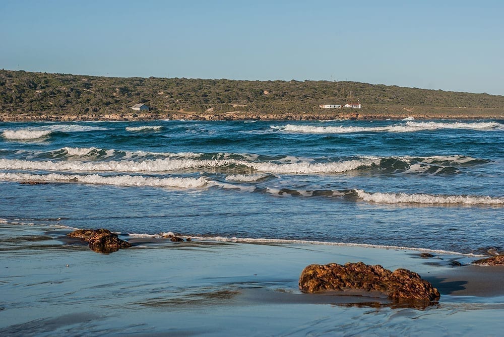
Surrounding area of Gouritsmond
Boggomsbaai, Vleesbaai and Fransmanspunt are part of the Gouritsmond area offering visitors a choice of accommodation and activities. The coastline has got in between rocky outcrops, cliff faces, sandy beaches, and dunes. The oceans temperature along the coast is regarded as warm all year round, ranging from a minimum of 16.5° in winter to a maximum 22.5° Celsius in summer. Surfing is good due to the constant break of the waves.

Accommodation in Gouritsmond
Glamping, guest houses and luxury accommodation villas are found at water’s edge, in nature reserves and in scenic valleys. Gouritsmond offers you fishing, hiking, horse riding, beaches, swimming and much more.

Gouritsmond fishing
Most of the time the river mouth at Gouritsmond is open to the sea making it a tidal river. During high tide water is pushed from the ocean up the estuary into the river bringing along marine fish like cob and grunter, excellent fishing alongside the Gouritsriver at that time. Angling off the beaches, rocks, rivers, and estuaries is great along this stretch of coastline.

Gourits River
The Gouritsriver is fed from Calitzdorp in the Klein Karoo region by the Gamka and Olifants rivers and just before the Langeberg Mountains the Groot river has its confluence. This makes it one of the principal rivers in the Southern Cape with a total length of 416 kilometers and only the last 129 kilometers is named the Gourits river. The total drainage area is 44 000 sq km, 370 km from wide from east to west and 257 km from north to south.
Being an important water source to the Southern Cape region seven dams were built, the Floriskraal dam in the Buffels river, the Gamkapoort dam in the Gamka River and the Stompdrif dam in the Olifants river are three of the main dams.
The main drainage area is from Karoo country with rainfall ranging from 102 to 305 mm and some is from the Swartberg and Outeniqua mountains with above average rainfall.

Gouritsriver Pass and Bridge
The Gouritsriver pass is 13.3 km long and runs along the N2 from Mossel Bay to ALbertinia. It crosses the Gouritsriver via the Gouritsriver bridge constructed in 1972 and is 65m high and stretches 220 meters across the river.
The well known “bungee” bridge or original old single lane bridge was constructed in 1892 and used for bungee jumps for several years until 2005 when it was stopped due to the safety of the construction.
When the railway line was opened in 1906 it used the same bridge until a new railway bridge was built up stream in 1931.
